English
0 item(s)
View cart
You have no items in your shopping cart.

You've done the scouting. You've got your tag. You've planned the packout route, the camp location, the approach. But have you thought about what happens when something goes wrong three miles from the nearest trail, with no cell signal, a spike camp partner who twisted an ankle, and a storm rolling in?
A solid communications plan is as essential to a backcountry hunting trip as your pack, your rifle, and your first aid kit. It's the piece most hunters skip until something forces the issue. This guide lays out how to build one from scratch: which devices are worth carrying, how to set up a check-in protocol, what to do in a true emergency, and how to match your comms gear to the specific terrain and hunt you're running.
Most of the country that holds the best backcountry hunting, deep wilderness units in Alaska, Montana, Wyoming, Colorado, Idaho, and beyond, sits well outside the reach of any cell network. You might catch a bar or two on a high ridge if you're lucky, but you cannot build a safety plan around that. And even in states with better cell coverage, deep canyon country, heavy timber, and remote drainages will swallow your signal without warning.
Cell phones also fail in the cold. Lithium batteries lose capacity fast below freezing, and most modern smartphones aren't built to take the abuse a hard backcountry hunt dishes out. If your only comms plan is an iPhone in your bib pocket, you're hunting without a net.
Satellite communication devices bypass the cellular infrastructure entirely. They talk directly to satellites overhead, which means they work in the Alaskan bush, the Wyoming breaks, the Arizona strip, anywhere you can see sky. For any hunt that puts you more than a few miles from a road or trailhead, satellite comms belong in your pack.
A good comms plan works in three layers, each one backing up the last.
Layer 1: Two-way communication. The ability to send and receive messages or make voice calls with your hunting partners, your camp, your outfitter, or a contact back home. This is your primary daily-use layer, check-ins, logistics, weather updates, letting someone know you filled your tag or need help.
Layer 2: Location tracking. A running breadcrumb trail of your GPS coordinates shared with a designated contact or hunting partner. If you go quiet and miss a check-in, your emergency contact can share your last known location with search and rescue immediately.
Layer 3: Emergency SOS. A dedicated, one-button distress signal that connects to a 24/7 monitoring center and dispatches rescue services to your exact GPS coordinates. This is your last resort, and you want it to be totally reliable when you need it.
Depending on your device choice, all three layers can come from a single piece of gear. But it's worth understanding each layer separately so you know what you're actually carrying, and what you're not.
The Garmin inReach Mini 2 weighs 3.5 oz and clips to a shoulder strap or hip belt. Don't let the size fool you, it runs on the Iridium satellite network, which means true global coverage including deep wilderness and both polar regions. You can send and receive two-way text messages, trigger automated GPS tracking updates on a schedule, and hit the SOS button to connect with the GEOS International Emergency Response Coordination Center, which stays on the line with you via message until help arrives.
The newer Garmin inReach Mini 3 adds a color touchscreen and upgraded performance, while the Garmin inReach Mini 3 Plus builds in even more capability for hunters who want the full feature set in a compact package. These are the best options for solo hunters who are counting grams, or as a lightweight secondary device for any member of a larger party.
Pair with a Garmin inReach subscription plan. The Freedom Plan lets you activate only during hunting season and suspend it when you're not in the field, so you're not paying year-round for a device you use hard for 60 days.
If you want full navigation in the same unit as your satellite communicator, Garmin's inReach-enabled GPS handhelds are purpose-built for exactly this use case.
The Garmin GPSMAP 67i combines multi-band GNSS navigation with a 3" sunlight-readable color display and full inReach satellite communication. It has preloaded TopoActive maps and is rugged enough for the worst weather you'll encounter. For hunters who rely on detailed topo navigation, reading drainages, marking wallows, planning approach routes, this is a workhorse.
The Garmin Montana 760i steps up to a large 5" glove-friendly touchscreen, making it ideal for cold-weather hunting where you need to navigate with thick gloves on. The big screen also makes it easier to review detailed topo in the field and plan packout routes on the fly.
The Garmin GPSMAP H1i Plus is built for the most demanding environments, combining the rugged, high-contrast display of the H1 series with full inReach global satellite communication. If you're hunting high elevation, severe weather, or truly remote terrain, this is the unit built for it. The GPSMAP H1 without inReach is also available at a lower price point for hunters who want premium navigation and plan to carry a separate communicator.
When you need voice capability, actual two-way conversation, not just texting, a satellite phone changes the equation. The Iridium Extreme (Model 9575N) is the most capable handheld satellite phone on the market for remote use. It's MIL-STD-810F rated, runs on the full Iridium constellation for global coverage, has a built-in GPS, and includes an integrated SOS button. You can call another satellite phone, a regular cell number, or a landline from the middle of nowhere.
For a hunting camp where the outfitter or camp manager needs to coordinate multiple parties across a large area, or stay in contact with a float plane pilot or pack string operator, a satellite phone is irreplaceable. It also gives you the ability to call family back home with actual voice, a reassurance that texts alone don't always provide. Not currently in camp? We also rent the Iridium Extreme by the week, which is a practical option for hunters who don't want to own a phone they'll use once a year.
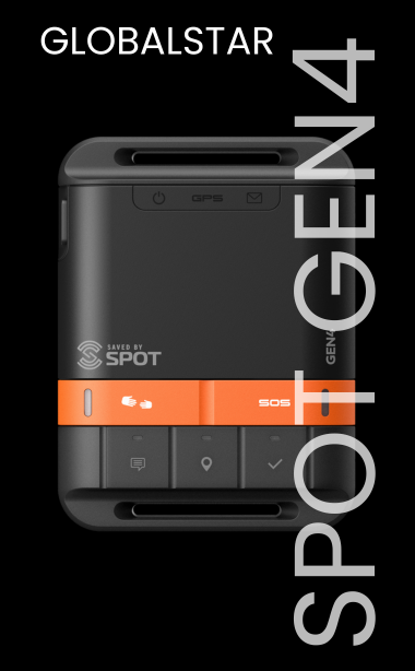
If you're newer to backcountry hunting or want an affordable entry point into satellite safety, the SPOT Gen4 at $149.95 gives you GPS tracking, SOS capability, and one-way check-in messaging at a price that's hard to argue with. It's a one-way device, you can send messages but not receive replies, but for a first satellite safety device, it covers the most critical use case: getting help to your location in an emergency and letting people know you're okay.
The SPOT X steps up to full two-way messaging with a built-in keyboard, Bluetooth pairing with your phone, and a backlit display for low-light use. It sits between the Gen4 and an inReach in both capability and price, and is a solid choice for hunters who want two-way messaging without the investment of a full Garmin unit.
Gear is only part of a comms plan. How you use it, and what your emergency contact does with the information, matters just as much. Before you leave the trailhead, establish the following with a designated contact back home or at base camp:
Set a check-in schedule. Decide on a time each day when you'll send a "I'm okay" message or make contact. Morning before you head out, or evening when you're back in camp, are both common. Stick to it. If a check-in is missed, your contact should know what to do next.
Define a missed check-in protocol. If you miss one check-in, your contact waits and tries to reach you. If you miss two consecutive check-ins with no response, they call for help. Define the threshold clearly before you leave. Two missed check-ins is a commonly used threshold, it accounts for device battery issues or a day where messaging was genuinely difficult without triggering unnecessary rescue responses.
Share your planned route and camp location. Send your GPS waypoints or topo map reference before you head in. If rescue is ever needed, your contact can share your planned location alongside your last tracked position, dramatically narrowing the search area.
Establish your SOS trigger point. Every hunting party should discuss in advance what constitutes an SOS situation. A sprained ankle that can be self-rescued is not an SOS. A broken femur, a cardiac event, a missing hunter after dark in deteriorating weather, those are. Knowing your threshold in advance means you won't hesitate or second-guess when the moment comes.
Satellite communicators are your lifeline out of the backcountry, but they're not ideal for minute-to-minute coordination between hunters working the same drainage. For that, carry a pair of quality handheld radios, a simple FRS/GMRS walkie-talkie setup works well for most terrain, with a range of a few miles on open ground.
Establish channel assignments before you split up for the morning. Agree on check-in times during the day, a midday check-in is often practical if you're running separate drainages and plan to regroup for the evening. If you're hunting a large wilderness area where radio range is a real limitation, the two-way messaging on a Garmin inReach becomes genuinely useful for coordinating with a partner on the next ridge.
For outfitters managing multiple guides and clients across a large area, an Iridium satellite phone at base camp combined with individual trackers or inReach units for each party creates a workable command picture without requiring a radio network.
Backcountry hunting weather can change faster than any forecast anticipates. A key advantage of the higher-tier Garmin inReach plans is access to weather forecasts delivered by satellite to your device, not a cached forecast from before you left the trailhead, but an updated forecast pulled from the nearest available data for your GPS coordinates. For mountain hunters who need to make go/no-go decisions on approach routes, river crossings, or ridgeline travel, this is genuinely valuable information.
Build weather check-ins into your daily communication rhythm alongside your safety check-ins. A morning weather pull before you commit to a route into high country can be the decision that keeps your hunt productive and safe.
Every satellite device is only as useful as its battery. Cold temperatures, which are a constant companion on any fall backcountry hunt, reduce lithium battery capacity significantly, sometimes by 30 to 50 percent below rated capacity. Plan for this.
Keep your communicator in an inner pocket against your body when temperatures drop, and pull it out only for tracking updates or messaging. Most Garmin inReach units allow you to set tracking intervals, a 10 or 30-minute tracking update uses considerably less battery than a 1-minute interval, and for most hunt days it provides more than adequate breadcrumb trails. Turn off Bluetooth pairing when you don't need it. Carry a small USB power bank as a backup, and make sure your entire group knows which devices can be charged from which sources at camp.
If you find yourself pressing the SOS button, here's what to expect and what to do:
The moment you trigger SOS on an Iridium-network device, a signal goes to the GEOS International Emergency Response Coordination Center, which operates 24/7 and is staffed by trained coordinators. GEOS will immediately attempt to contact you via satellite message to confirm the nature of the emergency and your status. Stay with your device and respond to their messages, this two-way communication is what makes the modern Garmin inReach system so effective compared to older one-way PLBs.
GEOS then contacts the appropriate local search and rescue authority, whether that's a county sheriff's office, a park service SAR team, or in Alaska, the Alaska Rescue Coordination Center, and shares your GPS coordinates, your emergency contact information, and the nature of the situation. From that point forward, SAR is in control of the response.
Your job is to stay put, stay visible, and conserve warmth and energy. If you can safely move to a clearing or high ground to improve visibility for aircraft, do so, but don't travel in a way that takes you away from your last known GPS position without informing your contact. Light a signal fire if conditions are safe. Use a signal mirror if you hear aircraft. Make yourself findable.
Solo day hunter, familiar terrain: Garmin inReach Mini 2 or Mini 3 clipped to chest strap, active tracking, check-in to a home contact once daily.
Two-person spike camp, remote unit: Garmin inReach units for both hunters, one GPSMAP 67i or Montana 760i for navigation, FRS radios for in-field coordination.
Three to four person base camp with spike hunters: Iridium Extreme satellite phone at base camp for voice capability, inReach Mini 2 or Mini 3 for each spike camp party, agreed check-in times twice daily.
DIY Alaska or Yukon hunt: Maximum redundancy. Satellite phone plus an inReach unit per person, coordinates shared with the float plane operator and a stateside emergency contact, twice-daily check-ins minimum.
First-time backcountry hunter, tight budget: SPOT Gen4 minimum. Step up to SPOT X if you want two-way messaging. Both are better than nothing by an enormous margin.
If you're headed out on a once-a-year trip and don't want to invest in a full satellite phone, Outfitter Satellite offers satellite phone rentals including the Iridium Extreme and Iridium 9555 by the week. Rental is a practical option for one-off high-country trips, early-season archery hunts in new territory, or any situation where you want the safety net without the long-term gear commitment.
No comms plan guarantees a safe hunt. But hunters who go into the backcountry with a clear check-in schedule, a designated emergency contact who knows what to do, and a reliable satellite device on their person are in an entirely different position than those who don't. Rescue teams will tell you: the difference between a good outcome and a bad one often comes down to how quickly they knew there was a problem and where to look.
The gear to make that happen is lighter, more affordable, and easier to use than it's ever been. Browse our full range of satellite communication devices for hunting and reach out to our team at (+1) 615-889-8833 or info@outfittersatellite.com if you have questions about which setup fits your hunt.