English

0 item(s)
View cart
You have no items in your shopping cart.
A missed check-in can be a minor inconvenience on a day hike. For a field crew beyond pavement, a vessel offshore, or a driver moving equipment through rural territory, it can quickly become an accountability problem. GPS trackers give supervisors, family members, and response teams a clear view of where people and assets were last known to be - and, with the right device and service plan, provide a way to request help when ordinary communications are unavailable.
The right tracker is not simply the smallest device with a map on the screen. Coverage, reporting interval, battery life, SOS capability, message requirements, and the conditions of deployment all matter. A tracker that works well for a weekend hunter may be the wrong choice for a utility team that needs automated location reports throughout a two-week assignment.
GPS is the positioning technology that allows a device to calculate its location using signals from navigation satellites. A tracker then sends that position somewhere useful, such as a web-based map, a dispatch platform, or a designated contact. The method it uses to transmit the location determines where it will work and what ongoing service it requires.
Cellular trackers send reports through local mobile networks. They can be effective for vehicles, equipment, and personnel operating where cellular service is dependable. Their limitations become clear outside populated areas, across remote highways, in canyons, offshore, and during disasters that disrupt local infrastructure.
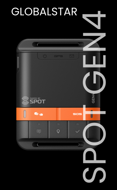
Satellite GPS trackers use a satellite network to send location data and, on many models, messages and SOS alerts. They are built for the coverage gaps where cellular devices stop being dependable. That makes them a practical option for backcountry travel, remote worksites, maritime use, disaster response, aviation support, and field operations across broad geographic areas.
A tracker is not automatically a two-way communicator. Some devices provide one-way location reporting and a dedicated SOS button. Others support preset check-in messages, custom two-way messaging, weather information, or coordination features. Choose the capability your operation will actually use, rather than paying for functions that add complexity without improving safety.
The first decision is whether you are tracking a person, a vehicle, an asset, or a combination of all three. Each use case creates different demands.
For an individual traveler, a compact personal tracker with check-in messages and SOS can provide reassurance without adding much weight. Hikers, hunters, overland travelers, and endurance athletes often value the ability to share a route, send a location update, and call for help outside cellular coverage. Battery life and ease of use matter because the user may be carrying the device all day.
For lone workers, the priorities may shift toward scheduled check-ins, escalation procedures, location history, and centralized visibility. A lone-worker program is only as strong as the response plan behind it. Managers should know who receives an overdue check-in alert, how they verify the situation, and when they involve local emergency services.
Vehicles and mobile equipment usually need hardwired or long-duration tracking. A unit that reports every 10 minutes may be suitable for occasional asset visibility, while a security-sensitive fleet may require more frequent reporting, geofencing, ignition status, or backup battery protection. More frequent reports improve visibility, but they also use more power and may increase service costs.
For marine and offshore work, confirm that the device, its mounting approach, and its charging method are appropriate for salt, spray, vibration, and exposure. For aviation use, consider mounting, antenna placement, power supply, and any operational procedures required by the aircraft owner or operator. The environment should drive the equipment choice.
A satellite coverage map is an essential starting point, but it is not a guarantee that every transmission will succeed instantly. GPS trackers need a reasonably open view of the sky to receive location signals and send messages through a satellite network. Dense tree cover, deep canyons, steep terrain, metal structures, and an improperly positioned antenna can delay or prevent communication.
This does not mean satellite tracking is unreliable. It means field users need to understand how to operate it. Carry or mount the device where it can see the sky, follow the manufacturer’s orientation guidance, and allow enough time for a message to transmit. Test it before the mission rather than assuming it will behave the same way in every environment.
Network selection also matters. Different satellite networks have different coverage strengths, device ecosystems, message capabilities, and plan structures. A team working in Alaska, the Gulf of Mexico, the western United States, or internationally should evaluate the intended travel area, not just select the least expensive monthly plan. For global or multi-region operations, consistency of service and support may be worth more than a small difference in monthly cost.
An automated breadcrumb trail is useful when it answers a real operational question: Where was the vehicle headed? Did the field team reach the worksite? When did the traveler leave the route? Are they moving after an SOS activation?
Short reporting intervals create a more detailed track. They can be appropriate for high-mobility work, expedition monitoring, or circumstances where a response team may need recent location information. They also consume battery capacity faster and can raise airtime usage. Longer intervals conserve resources, but they may leave large gaps between points.
For many personal uses, a 10- to 30-minute tracking interval is a sensible balance. For a fleet, remote equipment, or a team on a defined work schedule, the best interval depends on movement speed, risk level, power availability, and how quickly someone needs to recognize a missed or unexpected movement. There is no universal setting. Establish the setting as part of the mission plan, then review it after actual use.
An SOS button is one of the most valuable features on a personal satellite tracker, but it should never be treated as a substitute for preparation. Before departure, users should know when to activate it, what information can be sent, and whether the device supports two-way communication with an emergency coordination center.
The organization or family monitoring the device should also understand its role. An SOS may initiate contact with a professional emergency response service, while a routine check-in or late arrival alert may go to designated contacts. Those are different workflows. Give every contact a clear expectation of what to do and what details they should have available, including the user’s route, vehicle description, medical concerns, and planned return time.
Do not wait for an emergency to find out whether contacts are correctly entered or whether the subscription is active. Conduct a non-emergency test according to the device instructions. Verify that location reports appear where expected and that everyone involved understands the notification process.
Battery performance in product specifications is usually based on defined test conditions. Cold weather, frequent tracking, message activity, obstructed sky view, and aging batteries can reduce real-world runtime. Carry spare batteries or a power bank for handheld equipment when appropriate, and use external power or a hardwired installation for long-term vehicle and equipment tracking.
Mounting is equally important. A tracker concealed inside a metal compartment may have poor satellite visibility. A vehicle antenna installed without attention to its ground plane or cable routing may not perform as intended. On a person, a device buried at the bottom of a pack is less useful than one carried where it can communicate and be reached quickly. Good deployment prevents many problems that look like equipment failures.
Service plans deserve the same attention as hardware. Compare activation fees, monthly or annual charges, included tracking points, overage costs, suspension options, and international use. A seasonal hunter, a short-term project team, and a year-round fleet will rarely need the same plan. If the assignment is temporary, renting a device can be more practical than buying one, especially when the rental includes expert setup guidance and the right airtime option.
Outfitter Satellite can help match the device, network, and service plan to the way your people or equipment will actually operate, including short-term rentals and ongoing deployments.
The best GPS tracking program is simple enough to use under pressure. Assign the device to a person or asset, label it clearly in the tracking portal, confirm who monitors alerts, and document the check-in schedule. Train users to keep the device charged, maintain sky view, and report any change in route or assignment.
For organizations, a short pre-deployment checklist can prevent avoidable gaps: confirm service activation, test the device, verify emergency contacts, inspect power and mounting, and record the trip or work plan. Repeat the process when staff changes, routes change, or equipment has been stored for a season.
A GPS tracker cannot eliminate weather, mechanical failures, medical emergencies, or poor decisions in the field. What it can do is reduce uncertainty when uncertainty is most costly. Select one that fits the terrain, the mission, and the people responsible for responding, then test it before your next departure.