English

0 item(s)
View cart
You have no items in your shopping cart.

A technician misses a scheduled check-in at a pump station 70 miles from the nearest reliable cell signal. The question is not whether someone can send a text eventually. It is whether the team knows there is a problem, has a usable last known location, and has a defined response before a routine assignment becomes an emergency. That is the job of a lone worker satellite safety system.
For utility crews, environmental teams, remote inspectors, surveyors, offshore personnel, and expedition staff, satellite safety is more than an SOS button. It is a working process that combines the right device, satellite coverage, location reporting, escalation rules, and people ready to act. The best setup depends on where the worker goes, how often they work alone, and what the organization can realistically monitor.
A practical system creates visibility when cellular networks cannot. At a minimum, it should allow a worker to share location, check in on schedule, request help, and initiate a distress alert. For many operations, two-way messaging is equally valuable because it lets a coordinator confirm the nature of an issue, send instructions, or adjust a response without treating every missed check-in as a full emergency.
Satellite connectivity matters because the worker may be outside cellular coverage by design, not by accident. A land manager inspecting remote acreage, a pipeline contractor moving through rural terrain, or a field scientist working after a storm may cross in and out of service all day. A device that relies only on a smartphone is not enough for that assignment.
The system also needs to work under field pressure. Controls should be understandable with gloves on. Battery life must support the shift, including cold-weather conditions. The device needs a clear view of the sky when sending, and workers must know that dense canopy, canyon walls, vehicles, and buildings can affect transmission. Satellite is highly capable, but it is not magic. Deployment planning still matters.
It is tempting to compare features first: tracking intervals, screen size, battery capacity, and subscription cost. Those details matter, but the more useful starting point is the worker's exposure.
Consider whether the primary risk is injury, vehicle breakdown, medical emergency, weather, hostile encounters, delayed return, or loss of route visibility. A utility employee working near energized equipment has different communication requirements than a backcountry guide leading clients through mountainous terrain. A remote worker who remains in one work zone may need a different reporting cadence than someone driving hundreds of miles between sites.
Also define the consequence of a missed check-in. If a supervisor can reach the area within an hour, a simple scheduled check-in and location history may be appropriate. If the worker is on a remote drilling site, at sea, or beyond road access, the response plan may require frequent tracking, two-way communication, and a monitoring partner able to initiate procedures at any hour.
This is where many safety programs fall short. They issue a tracker, add a plan, and assume the technology has solved the problem. The device is only one layer. The real protection comes from a documented workflow that tells people what to do when the device reports trouble, silence, or an SOS.
Satellite networks have different strengths, device options, and coverage footprints. For US-based crews with broad domestic or global travel requirements, network selection should be based on the actual operating geography, not a coverage map viewed from an office.
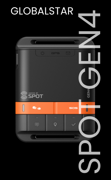
For example, some satellite messenger and personal locator devices are designed for lightweight tracking, check-ins, and emergency SOS. They can be an excellent fit for individual workers, short field assignments, and teams that need dependable location visibility without voice calling. Other devices add two-way messaging, weather information, route management, or more detailed tracking controls.
A satellite phone may be the better tool when workers need to discuss complex conditions, coordinate equipment recovery, communicate during a prolonged incident, or maintain voice contact from remote sites. In higher-risk operations, a tracker and a satellite phone can work together: one provides scheduled visibility and alerting, while the other supports detailed communication.
Coverage must be tested in the environment where the work happens. Mountain valleys, thick forest, urban obstruction, vessel cabins, and vehicle interiors all create different challenges. For frequent vehicle-based work, an external antenna, dock, or purpose-built mobile installation can materially improve usability. For maritime or aviation deployments, select equipment designed for that operating environment rather than adapting a recreational device beyond its intended use.
A lone worker satellite safety system should have clear rules for normal operations and emergencies. The worker needs to know when to check in, what each preset message means, when to use SOS, and how to maintain a clear sky view. The monitoring team needs to know who receives alerts, who has authority to escalate, and how to access location history and worker details.
A straightforward workflow might include a start-of-shift message, location tracking during travel, an arrival message at the work site, a departure message, and an end-of-shift confirmation. That sequence gives supervisors useful visibility without forcing workers to send unnecessary updates.
Emergency procedures should be more specific. Define who contacts the worker first, how long the team waits for a reply, when local emergency services are contacted, and what information responders receive. Keep vehicle details, medical notes where appropriate, route plans, site coordinates, supervisor contacts, and local response information current. A device-generated SOS is vital, but an organized response record helps turn that alert into action.
Training is part of the workflow, not an optional add-on. Ask workers to send messages, test check-ins, view their location, and practice the SOS procedure during onboarding. They should understand that SOS is for genuine emergencies and that they should remain available, preserve battery power, and move to a clearer view of the sky if conditions allow. Regular testing also exposes account setup errors before a live incident.
More frequent tracking produces a clearer route history and can reduce the search area when something goes wrong. It also uses more battery power and may increase airtime costs, depending on the plan and device. There is no single correct setting.
For a worker driving between remote sites, intervals of several minutes may provide meaningful movement data. For a stationary inspection point or a field crew working within a defined area, longer intervals may be adequate. During elevated-risk periods, such as severe weather, solo travel on unmaintained roads, or work near a hazard zone, the team may temporarily use more frequent reporting.
The key is to make tracking intentional. Avoid both extremes: an interval so infrequent that it offers little operational value, or a setting so aggressive that batteries are depleted before the shift ends. Review actual trip data after deployment and adjust based on real conditions.
Permanent equipment ownership makes sense for organizations with ongoing remote assignments and repeatable safety procedures. It supports standardized training, consistent accessories, and a known inventory of devices ready for deployment. Long-term users should also consider spare batteries, charging options, protective cases, and replacement plans for lost or damaged units.
Rental can be a practical choice for seasonal projects, emergency deployments, short field campaigns, or teams evaluating a device before building a larger program. It avoids buying equipment that may sit unused for most of the year. The trade-off is that availability, lead time, and setup requirements should be addressed before the crew mobilizes.
Airtime plans deserve the same attention as the hardware. Confirm what is included for tracking, messages, SOS support, and any voice or data use. Consider whether the plan can scale during peak season and whether it supports the countries or waters where your people actually operate. Activation should be completed early enough to test every unit before it leaves for the field.
The most common failure is treating satellite safety equipment as a box-checking purchase. A device stored in a truck, assigned without training, or connected to an unmonitored account does not provide meaningful lone-worker protection.
Another gap is relying on one communication method for every scenario. A compact messenger may be ideal for check-ins and SOS, while a satellite phone may be necessary for complex coordination. Likewise, a phone without scheduled tracking may leave managers with less visibility than they need. Match the tools to the mission rather than forcing one product to cover every requirement.
Finally, do not overlook power and placement. A fully charged device secured to the worker is far more useful than one left in a vehicle. If a worker can become separated from a truck, ATV, vessel, or aircraft, the primary safety device should stay with the person.
Outfitter Satellite can help teams compare networks, devices, airtime options, and rental needs based on their real operating conditions. The right system is the one your workers will carry, your managers will monitor, and your organization will be prepared to act on when it matters.