English

0 item(s)
View cart
You have no items in your shopping cart.

A crew misses its scheduled check-in from a wildfire survey area, an offshore technician changes course around weather, or a field researcher moves beyond the last usable cell tower. Those are the moments when satellite tracking for remote teams becomes an operational tool, not a nice-to-have map feature.
For organizations that send people into backcountry, open water, disaster zones, remote utility corridors, or undeveloped job sites, location visibility must continue when local infrastructure does not. The right tracking program gives supervisors a practical way to confirm status, receive alerts, coordinate a response, and document that reasonable safety procedures were in place.
A satellite tracker uses a GPS receiver to determine its location and a satellite network to send that position to a monitoring portal, mobile application, or designated contacts. Because the device communicates through satellites rather than local towers, it can operate well outside normal cellular coverage, provided it has a reasonable view of the sky and the selected network covers the area.
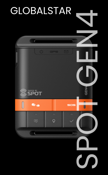
Most team trackers can send scheduled position updates at intervals such as every 2, 10, 30, or 60 minutes. Many also support manual check-ins, preset messages, two-way text communication, and an SOS button that connects the user with a professional emergency response coordination service or designated emergency contacts, depending on the device and service plan.
The difference between tracking and communication matters. A basic tracker may show a moving location trail and allow SOS activation, but it may offer limited messaging. A satellite communicator can provide location sharing plus two-way text, weather updates, and more detailed coordination. A satellite phone is usually the better choice when a team needs real-time voice communication, though it is not always the most efficient option for routine tracking.
A shared map is useful only when it reflects current, dependable information. Teams working beyond coverage face gaps caused by terrain, weather, battery failures, changing plans, and simple human error. Satellite tracking creates a check-in process that does not depend on an employee finding a cellular signal at the end of a long shift.
For a lone worker, the primary value may be the ability to signal that a task is complete or request help after an injury, vehicle breakdown, or encounter with hazardous conditions. For a field crew, tracking helps managers understand where people and equipment are relative to roads, work zones, evacuation routes, or weather threats.
It also reduces uncertainty. If a worker is overdue, supervisors do not need to begin with the question, “Where should we look?” Recent coordinates, travel direction, and last communication time provide a more useful starting point for escalation.
That visibility should support workers, not turn into unnecessary surveillance. The most effective programs explain what is tracked, when tracking is active, who can access the information, and how long records are retained. Clear policies protect employee trust while giving the organization the information it needs during a genuine safety event.
There is no single tracker that fits every deployment. Coverage area, message volume, update frequency, environmental conditions, and response procedures should drive the selection.
Coverage is the first question. Iridium-based devices are often selected for teams that require broad global coverage, including polar regions and ocean routes. Other satellite networks may be appropriate for regional deployments where their coverage footprint and service options match the operating area.
Do not assess coverage only at the country level. Mountain walls, dense forest canopy, steep canyons, buildings, and a device carried inside a vehicle can affect signal acquisition and message delivery. A tracker needs a clear enough view of the sky, and transmission may take longer in obstructed terrain. Field testing at the actual work site is more valuable than relying on a coverage map alone.
A basic location beacon can be sufficient for a team that needs periodic breadcrumb tracking and a one-way check-in. It is a cost-conscious choice for straightforward assignments where supervisors mainly need confirmation that a vehicle or employee remains on route.
Choose a two-way satellite messenger when workers may need to describe a problem, receive updated instructions, or coordinate a non-emergency pickup. An SOS button is valuable, but SOS is not a substitute for routine communication. A worker with a mechanical issue, delayed arrival, or changing weather may need help without declaring a life-threatening emergency.
For crews that must discuss technical work, medical conditions, routing changes, or incident details by voice, pair tracking devices with satellite phones or satellite-enabled internet. The best setup is often a layered one: trackers for every field employee, with higher-capability communication equipment assigned to team leads, vehicles, vessels, or base camps.
Frequent location updates improve situational awareness, but they increase battery consumption and can increase service costs. A utility inspection crew driving established routes may only need updates every 10 or 15 minutes. A solo surveyor moving through rugged terrain may warrant shorter intervals, particularly during travel between sites.
Use faster tracking during higher-risk periods, such as aviation support, water crossings, storm response, night travel, or operations near active fire areas. For stationary work, a timed check-in or an “arrived on site” message can be more useful than constant location pings.
A tracker in a glove compartment does not create a safety program. The device must be assigned, activated, charged, tested, and integrated into a clear operating procedure.
Before deployment, register each device to the correct employee or asset, confirm contact lists, verify mapping portal access, and test outgoing messages. Workers should know how to send a check-in, initiate two-way messaging if available, activate SOS, and cancel an accidental SOS. They should also understand that an SOS activation requires them to stay safe, communicate when possible, and follow instructions from responders.
Supervisors need an escalation plan that answers practical questions: What counts as a missed check-in? Who tries the worker first? When does the team contact local authorities or emergency coordination services? Who has access to trip plans, medical information, vehicle details, and last-known-location data?
Keep this procedure simple enough to use under pressure. A one-page field protocol is often more effective than a detailed manual that no one opens during an incident.
Battery management is one of the most common causes of tracking failure. Configure the reporting interval before the shift, charge devices fully, and carry a power bank, spare battery, or vehicle charging solution where appropriate. Cold weather shortens battery life, so workers should keep handheld units close to the body when conditions allow.
Placement affects performance. A handheld tracker should be carried where it can access the sky, not buried at the bottom of a pack. Vehicle and asset trackers may require external antennas or installation methods designed for the vehicle type. Marine and aviation environments introduce additional considerations, including water resistance, vibration, mounting, and uninterrupted power.
Teams should also carry backup navigation. A satellite tracker is excellent for reporting position, but it should not be the only way a worker can navigate. Downloaded maps, paper maps, compasses, route plans, and trained judgment still matter when a device is damaged or conditions change.
Purchasing makes sense for recurring field programs, long-term compliance requirements, and organizations that need devices ready for immediate deployment. Ownership gives teams consistency in training, accessories, and device configuration, while recurring airtime plans can keep units active year-round.
Renting can be the better fit for seasonal wildfire support, a short research expedition, temporary construction work, disaster response, or a one-time remote event. It avoids tying up budget in equipment that may sit unused for most of the year. A mixed fleet is common: owned trackers for permanent staff, rented satellite phones or terminals for surge operations and temporary command posts.
Outfitter Satellite can help teams compare networks, device capabilities, rental options, activations, and airtime plans based on the conditions they actually face. The goal is not to add technology for its own sake. It is to ensure each worker can be located and reached when ordinary communications stop working.
Satellite tracking is most effective when it supports disciplined field operations: a written travel plan, scheduled check-ins, charged equipment, trained users, and supervisors who know what to do when a message does not arrive. It cannot remove every risk from remote work, but it can replace a dangerous information gap with a known location, a communication path, and a faster route to help.
Before the next crew leaves the coverage map, test the devices, confirm the response plan, and make sure every person understands how to use the equipment in the conditions they will actually encounter.