English

0 item(s)
View cart
You have no items in your shopping cart.

A satellite communicator earns its place when the trail disappears from the map, a crew is beyond radio range, or a delayed check-in becomes a real concern. The Garmin inReach versus SPOT decision is not simply about buying an SOS button. It is about selecting the level of communication, coverage, tracking, and accountability your trip or operation requires.
Both brands provide a practical way to summon help and share location outside cellular coverage. Their biggest difference is what happens before an emergency. Garmin inReach devices are built around two-way satellite messaging on the Iridium network. SPOT offers straightforward tracking and emergency capability on the Globalstar network, with select models adding two-way messaging. The right choice depends on where you go, who needs visibility, and how much communication you need when plans change.
Garmin inReach is generally the stronger fit for users who need to hold a real conversation from the field. With an inReach device, a hunter can tell family that camp has moved, a remote worker can report a mechanical delay, and an expedition leader can coordinate a revised pickup point. Messages can be sent to mobile numbers, email addresses, or other compatible devices, subject to the selected service plan and conditions.
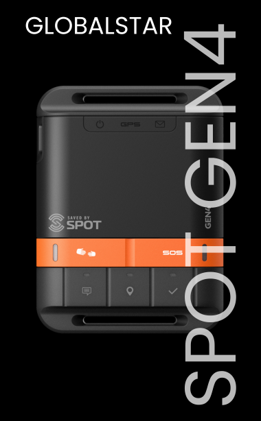
SPOT is often the more focused choice for predictable check-ins, routine breadcrumb tracking, and emergency notification. A SPOT Gen4, for example, is designed for users who want to press a button to send an OK message, request non-emergency assistance, trigger SOS, or transmit their position at regular intervals. That simplicity can be an advantage for a weekend trip, a lone worker with an established route, or an asset that needs location reporting without a lot of field interaction.
The distinction matters operationally. A one-way check-in confirms a preset message and location were sent. Two-way messaging lets the recipient answer, ask follow-up questions, and help make a better decision before a situation becomes urgent.
Network selection should be the first technical question in any satellite-device comparison. Garmin inReach communicates through the Iridium satellite network, which is designed for global coverage, including remote oceans and polar regions where a clear view of the sky is available. For international expeditions, offshore work, aviation operations, and teams that may deploy to changing locations, that reach is a major reason to choose inReach.
SPOT devices use the Globalstar satellite network. Coverage can be very effective across much of North America and other supported regions, but it is not identical to Iridium coverage. Before relying on SPOT for a specific trip, verify coverage for the exact route, including border areas, offshore passages, canyons, and high-latitude destinations. A device that works well for a Rocky Mountain hunting lease may not be the right communicator for a remote Alaska, ocean-crossing, or international deployment.
Neither network removes the physical realities of satellite communication. Dense tree cover, steep canyon walls, vehicle roofs, buildings, and poor antenna orientation can delay or prevent a message. Give the device the clearest possible view of the sky, keep it outside a pack when tracking, and allow enough time for a transmission to complete. Field discipline is part of reliability.
Garmin inReach devices are available in several formats, from compact messengers such as the inReach Mini line to handheld navigators and the inReach Messenger. The common benefit is the ability to exchange messages. This is valuable when an issue is serious but does not call for a rescue response.
Consider a field technician whose vehicle develops a tire problem on an isolated access road. With two-way messaging, the technician can send coordinates, explain that they have shelter and supplies, and receive a response confirming that a replacement vehicle is on the way. The operations center retains visibility without automatically escalating to emergency services.
SPOT X adds two-way satellite messaging to the SPOT lineup, making it a better comparison to Garmin inReach than a basic SPOT tracker. It can be a practical option for users who want two-way communication in supported Globalstar coverage areas. However, the device experience, coverage footprint, plan structure, and message workflow should all be evaluated against the inReach alternative before standardizing a team on one platform.
For customers who only need a scheduled proof-of-life signal, SPOT's simpler devices can be easier to deploy. A preprogrammed message such as “On route and OK” is fast to send and easy for a family member or supervisor to understand. The trade-off is that if the recipient needs more detail, they may not be able to ask the device user directly.
Both Garmin inReach and SPOT devices provide an SOS function that connects the user to a staffed emergency monitoring center. When activated, the device transmits the user's location and begins an emergency response process. If possible, responders work to determine the nature of the emergency and coordinate appropriate assistance with local authorities and rescue resources.
On an inReach device, two-way messaging can provide useful details during the emergency: the number of people involved, injuries, weather, shelter, medical concerns, or whether a helicopter landing zone is available. That information can improve situational awareness for emergency coordinators and can help users avoid triggering SOS when a non-emergency recovery is more appropriate.
A SPOT SOS button remains a meaningful safety layer, particularly for users who want a dedicated emergency device with simple controls. But no satellite messenger should be treated as a substitute for trip planning, navigation, first-aid training, survival equipment, and a documented check-in procedure. Rescue can take hours or longer depending on weather, terrain, local resources, and the accuracy of information available to responders.
Tracking turns a satellite device into an accountability tool. It can show a route history, provide time-stamped location updates, and help a designated contact recognize when someone has stopped moving or changed course. For remote workforce managers, that visibility supports lone-worker procedures, travel oversight, and incident response.
SPOT has long been a practical choice for location tracking. If a team primarily needs to see where vehicles, crews, or individuals are moving, a SPOT tracker may meet the requirement at a lower entry cost than a full two-way messenger. It is especially useful when users need minimal training and the organization has clear procedures for missed check-ins or unexpected route changes.
Garmin inReach also provides tracking, while adding the ability to explain what the location data means. A paused track point could mean a planned lunch break, a washed-out road, a medical issue, or a change in assignment. Two-way communication closes that information gap. For high-consequence work, that can justify the higher device and service investment.
Do not compare only the purchase price. Satellite communicators require an active service plan for messaging, tracking, and SOS functionality, and plan costs vary by provider, message allowance, tracking interval, annual commitment, activation terms, and region. Review the current plan details before deployment, especially if you expect heavy message traffic or frequent position reporting.
A basic SPOT device can make sense when the mission is simple: periodic tracking, preset messages, and an emergency button for a defined period in supported coverage. Garmin inReach is usually worth the additional cost when communications must remain flexible, destinations are global, or the consequences of not being able to exchange details are significant.
For a one-time expedition, seasonal hunt, disaster assignment, or temporary field project, renting a satellite communicator may be more efficient than buying a device and maintaining year-round service. For ongoing staff safety programs, ownership with a standardized plan, training process, and contact protocol usually provides better long-term control.
Choose Garmin inReach if you need global satellite coverage, two-way communication, detailed coordination during an incident, or a device that supports both individual travel and operational fieldwork. It is well suited to remote guides, international travelers, offshore crews, researchers, expedition teams, and lone workers whose plans can change quickly.
Choose a basic SPOT tracker if your activity stays within verified Globalstar coverage and your priority is affordable tracking, simple check-ins, and SOS access. It can be an effective fit for domestic recreation, established overland routes, vehicle monitoring, and straightforward worker check-in programs. Consider SPOT X when two-way messages are needed but Globalstar coverage and its device workflow fit the mission.
Before leaving coverage, activate the device, update contacts and preset messages, test it outdoors, and make sure every recipient knows what each message means. If your route, team size, or operating area makes the choice unclear, Outfitter Satellite can help match the device, airtime plan, and deployment procedure to the risks you actually face. The best satellite communicator is the one your people understand, carry correctly, and can depend on when the plan changes.